Tuesday, November 29, 2016

Smokies Fires....This just in....LeConte Lodge and Elkmont Undamaged by Fire

Great Smoky Mountains National Park officials have announced that LeConte Lodge, the popular backcountry lodging facility at the base of Mount LeConte, and the Elkmont Campground and Historic Districts sustained no damage from the fire activities in the park on Monday evening. Some Elkmont buildings sustained roof damage from falling trees caused by heavy winds, and some roof repairs will be required. 

The fires in the park and Gatlinburg community have now collectively been estimated to total over 15,000 acres. Tomorrow, November 30, the park will turn the fire management operation to the Southern Area Type I Incident Command Team (Dueitt) to manage the ongoing fire activities within the park. This team consists of federal and state interagency team members from across the country who collaboratively manages wildland fire and other incident management activities such as natural disaster relief efforts.

As you know....Fires in the Smokies

There have been numerous fires in the GSMNP up until last nights devastation took place when fires blew out of the park into the Gatlinburg area.  The winds were enormous throughout the area and were reaching over 80 mph in some parts.
The following are parts of dispatches from the GSMNP HQ that began coming out early this morning.   

"Great Smoky Mountains National Park officials have closed all facilities in the park due to the extensive fire activity, and downed trees. Park Headquarters is currently without power and phone services."

"Unpredicted, extreme weather conditions on Sunday afternoon through Monday led to the exponential spread of fires both inside and outside of the National Park. Severe wind gusts of over 80 mph, unprecedented low relative humidity, and extended drought conditions caused the fire burning in the National Park to spread rapidly and unpredictably, in spite of suppression efforts on Sunday that included helicopter water drops. Wind gusts carried burning embers long distances causing new spot fires to ignite across the north-central area of the park and into Gatlinburg. In addition, high winds caused numerous trees to fall throughout the evening on Monday bringing down power lines across the area that ignited additional new fires that spread rapidly due to sustained winds of over 40 mph.

"Conditions remain extremely dangerous with trees expected to continue to fall. Officials are asking that motorists stay off the roadways throughout the area. Travel in the Gatlinburg area is limited to emergency traffic only. The National Park is closed at the Gatlinburg entrance."
"Hundreds of acres within the park have burned, including areas of Chimney Tops, Mt. Le Conte, Bullhead Trail, and Roaring Fork Motor Nature Trail."

Wednesday, November 2, 2016

Backcountry Fires

Great Smoky Mountains National Park officials announced a temporary ban on campfires in the park’s backcountry effective immediately. Due to extremely dry weather conditions and the amount of fresh leaf litter on the ground, the potential for escaped fires to occur in the backcountry has dramatically increased. The fire restriction will be in effect until further notice.

The fire ban only applies to campers utilizing the park’s 100+ backcountry sites and shelters. It does not affect campers at the park’s 9 frontcountry (developed) campgrounds or picnickers using fire grills at picnic areas. Fires at developed areas must be confined to designated fire rings and grills. All visitors are asked to take certain precautions to help reduce the risk of wildfires. This includes extinguishing frontcountry fires by mixing water with embers in fire rings and grills.
Use of backpacking stoves is still permitted at backcountry campsites.
“With the current drought conditions, it is imperative that we reduce the risk of human-caused wildfires during this period of extreme fire danger,” said Superintendent Cassius Cash. “The park has not banned backcountry campfires since 2007, but these unusually dry conditions warrant the restriction.”  

Backpackers should be aware that this situation affects the availability of water at springs at backcountry campsites and shelters throughout the park. At some locations where there is a running spring, it can take more than five minutes to fill a quart-sized bottle. The following backcountry campsites are currently known to be without water: 5, 6, 16, 26, 113, Mollies Ridge Shelter, Russell Field Shelter, Spence Field Shelter, Silers Bald Shelter, Double Spring Gap Shelter, and Pecks Corner Shelter. Other campsites may be without water as the drought conditions continue. Backpackers are encouraged to carefully consider their itinerary and carry extra water for those sites that are not located along major water sources.

For more information about backcountry trip planning, please visit the park website at https://www.nps.gov/grsm/planyourvisit/backcountry-camping.htm or call the backcountry office at 865-436-1297.

Wednesday, October 26, 2016

Porcupine Creek near Big Sky Montana a couple weeks ago

This trail offers several options once you get back into it about a mile or more with the routes on the maps and not so formal routes created by mountain bikers along the front of the ridge line to your left as you go in on #34, the Porcupine Creek Trail.  Almost 2 mls. in you can split to the right on Porcupine Meadows trail which I did in previous years and it offers some great views across the valley of Lone Peak and the  southern edge of the Spanish Peaks along a relatively moderate hike.
A few miles into #34 your hiking mostly in forest however it opens often with views of mountains and the beautiful Porcupine Creek on your right as you go in.


These pictures are of some of the animals we did see along the walk that day.  You may need to click on the photo to enlarge them for a clearer view of the mule deer and squirrel.


And, if we had seen what left this print I hope we would have had been so far away you'd have to take our word for it!


Friday, October 21, 2016

Hiking in Montana

Hello, and Wow!  What another awesome week of appreciating the Rocky Mountains in Montana on foot (Oct. 11th-18th).  I have been fortunate and lucky enough to revisit this area of SW Montana over the last few years and hike a bunch while doing so.  This year "The Mysterious One", was able to come along and see what I have been telling her about since I rekindled this contact with old friends and schoolmates in MT.
The difficulty of these trails we hiked is described in terms of someone in good health, including a healthy lung and heart capacity to utilize the thinner air, and of course muscular endurance.
I note these things as important because some of the trails we hiked around the Big Sky area began at over 5000' in elevation, were consistent in the incline up to higher elevations, and we dealt with both snow and mud which added to the amount of energy needed to cover the walks we took.  The energy level was not only the physical strength but also the bodies ability to process the thinner levels of oxygen and keep those muscles from cramping.  We snacked on GORP (Good Old Raisins and Peanuts+), fruit and nut bars with real fruit and nuts, and packed some healthy sandwiches for lunch at the turnaround points each day. 
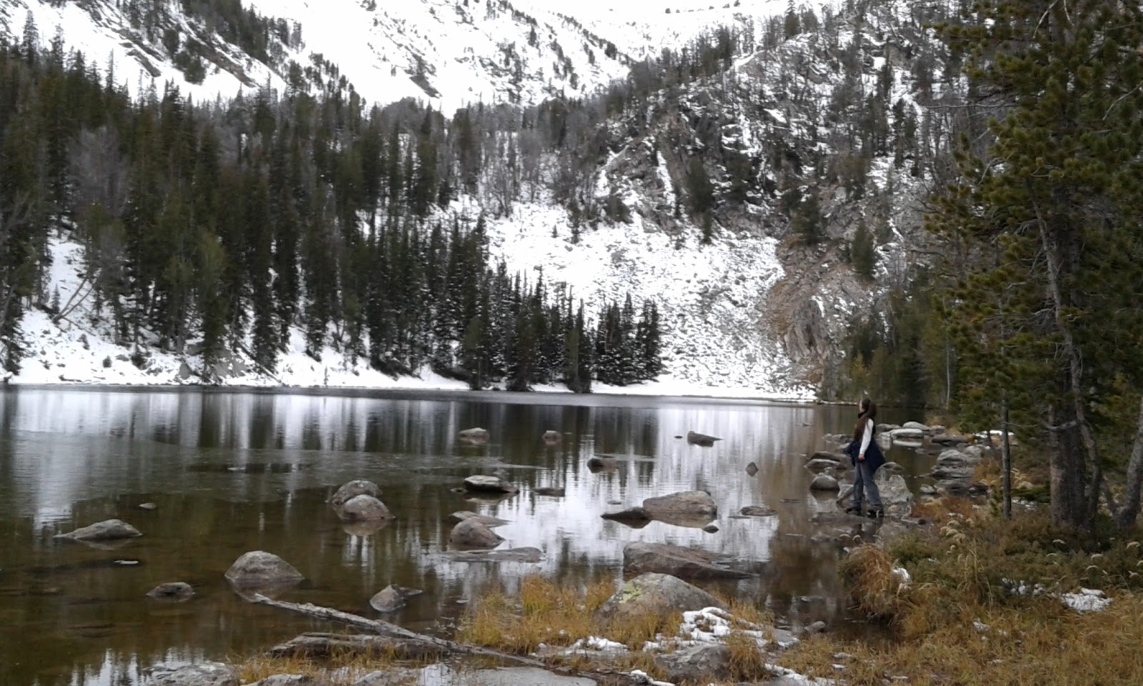
These pictures are from some of the hikes we took, two of them new to me included completing the Deer Creek trail and hiking the Corbly Gulch trail out of Bozeman.  The hike to Moon Lake via the Deer Creek Trail was over 10 mls, with half of that an incline on a sometimes rocky or muddy trail, but well worth the effort.  So, I would describe all but the Porcupine Creek hike as difficult just to error on the side of caution.
This photo below is looking out into the Gallatin Valley from about 3 mls. up the Corbly Gulch Trail.  This trail is used a bunch by locals both on bikes and foot and will take you to the pass just below Sacajawea Peak in the Bridger's.
The mountain bikers outnumbered the hikers the day we were on it 3-1.  There was both snow and sunshine as we  hiked this trail, much like the Smokies in how we may have rain and partly cloudy skies on a day hike.  And maybe more than once depending on the length of the hike.
On this Corbly Gulch trail we were able to view the vast size of the Gallatin Valley.
Over the week we saw lots of animals but no bears only this print about 5.5 mls into a hike on the Porcupine Creek Trail.  Funny, we were about to sit down and eat and turn around anyway.  Which is what we did with much more awareness as we had our sandwiches and rested for a few minutes. 

This week was another reminder and motivator for me to speak out and participate in preserving and protecting those vital systems to our survival as a species.  The earth will survive without us just fine.


Thursday, September 22, 2016

Pre Fall Colors along the Rich Mtn Trail

Another awesome day along this 2+ ml. section of trail which we've hiked many times.  I as usual find this hike relaxing in a mental sense and challenging on a physical level, depending on how fast you proceed along this mostly uphill climb.  That is 2+ mls. of incline of course if you're beginning from the parking area just outside the park where Rich Mtn. rd. exits from the park boundary.
The trees are still pretty full though I noticed in the long range forecast that the temps will be falling drastically next week so this will change. 
Along this walk I saw birds, squirrels, purple, white and yellow blooms, but no bears.....yet.  The mast crop was plentiful and there was fresh scat to indicate their presence along most of the trail.
And at one point lots of  'shrooms.
I enjoyed sitting for a few minutes at the top and just listening before returning the way I came.