Thursday, April 18, 2019
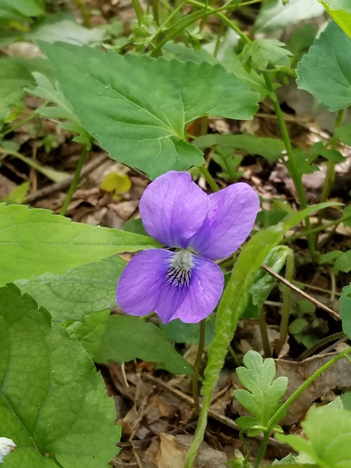
Spring Blooms in the Smokies!
Dudes and Dudettes! These awesome spring blooms were seen on one of my routes "off the grid", aka a manway or old trail which is no longer used, usually.
Hope you enjoy your spring wherever you are!


Sittons Gulch Trail, Cloudland Canyon SP
Cloudland Canyon State Park which is located in N Georgia, contains some beautiful vistas and water falls along some easily accessible trails such as Sittons Gulch.
The "Mysterious One", and I accessed this awesome trail for a 6 mile day hike from the trailhead just outside Trenton, GA.

This hike was a few days ago (4/14), and given the recent rains the trail was vacant when we arrived except for a park ranger gathering something off the trail which we could not identify.
Maybe gathering data for some scientific study on trees or invasive species, or maybe some garbage.
There is a previous entry on this site regarding this route however we deviated from the trail just before the falls and explored another. Wildflowers were plentiful along this route and the wildflower trail that loops off of the main trail and returns to the parking area if your heading in that direction.
Hiking this trail should be considered a moderate level of difficulty, with some steep grades at times, which could be difficult for some.
 If one is in Chattanooga or vicinity, this trail is relatively close, 30 mins. or less, and would make for a nice walk on a Sunday afternoon before the work week begins.
The "Mysterious One", and I accessed this awesome trail for a 6 mile day hike from the trailhead just outside Trenton, GA.

This hike was a few days ago (4/14), and given the recent rains the trail was vacant when we arrived except for a park ranger gathering something off the trail which we could not identify.
Maybe gathering data for some scientific study on trees or invasive species, or maybe some garbage.
There is a previous entry on this site regarding this route however we deviated from the trail just before the falls and explored another. Wildflowers were plentiful along this route and the wildflower trail that loops off of the main trail and returns to the parking area if your heading in that direction.
Hiking this trail should be considered a moderate level of difficulty, with some steep grades at times, which could be difficult for some.

Sunday, April 7, 2019
Rich Mtn Campsite #6
 Wow, dudes and Dudettes! The Mysterious One and I went out for an overnight on Rich Mtn, staying at campsite #5. This may not seem like much, however, it was my birthday and...….
I was feeling the affects of more than a months time of relative inactivity due to a bad sinus infection, work, travel and other uncontrollable variables in life. So we hiked up Rich Mtn trail from the Townsend end of that route (2.3mls of incline), and Saturday we hiked the 1.9 mls of the Indian Grave Gap trail down to Rich Mtn Rd. and back to the campsite. Here we ate some, rested a little, collected our gear and walked back to the car.
The 8.4 mls total was all I needed while trying to get my energy levels back after the illness.
For those who are not familiar with this route the 2.3 mls out of the parking area up to campsite #5, this should be considered more on the difficult side of moderate. From this direction the Rich Mtn trail has a consistent incline for much of the 2.3 ml distance.
From the campsite area to the Indian Grave Gap trail there are moderate to sometimes more than moderate declines over the 1.9 mls down to Rich Mtn rd. Which means that there are some steep inclines on the 1.9 ml. ascent when we returning.
The last 1.1 mls of this section of Indian Grave Gap, provided really nice vistas of the Appalachian Mtns and views into Cades Cove at times. These views will become limited to non-existent with the return of foliage in the next few days/weeks.


Friday evening and overnight we had no human contact and with little food available for the bears none of those critters were seen, yet. Now regarding humans that all changed Saturday! We saw folks hiking the loop from Cades Cove as we messed around the campsite, some folks coming up Rich Mtn trail from the direction we had come and while hiking Saturday we saw a bunch more folks as they were passing through this section on the loop from Cades Cove.
Lots and lots of folks over the day.
Oh! and one dude was just heading down the Rich Mtn trail late in the afternoon and as he passed by the campsite, he asked to confirm his route, "Hello", he said, "this is the loop right?". I quickly redirected him in the correct direction after determining the direction he came from and where he wanted to return to, Cades Cove. I offered him a park map but he felt he could find his way from there.

Subscribe to:
Posts (Atom)