Thursday, December 27, 2018

Hiking in the GSMNP during the president's Government shutdown

Wow! I have had the opportunity to hike a few times in the Great Smoky Mountains NP, since this mindless government shutdown and have been surprised how many people are there! Mostly Christmas traffic it appears with folks just driving around and through the park.

On the 24th, I went otg near the Middle Prong trail and enjoyed the quiet noise of the streams.
Today the 27th, "The Mysterious One", and I walked up the Lumber Ridge trail for a couple of miles in sometimes extremely strong winds when on the exposed side of the mountain or near passes.  Much of the road system in the park was closed throughout the day due to downed trees.


Hopefully the federal employees all across the country and elsewhere will be back to work soon.

Sunday, December 23, 2018

Park's across the country are officially closed

The following is the federal government/Department of Interior's shutdown policy. www.doi.gov/shutdown

Though the roads, weather permitting, in the GSMNP are open all visitor centers and bathrooms are closed.

Friday, December 21, 2018

Snow in the Smokies

Well it is snowing above 3000', and has pretty much shutdown the GSMNP, with a heavy wet snow. Follow this link to get the latest information on travel through the park. Which is pretty much not happening.
https://twitter.com/smokiesroadsnps

Monday, December 17, 2018

Little River Trail via Abrams Creek Campground

Wow Dudes and Dudettes! what an awesome day for a walk in the woods. With temperatures in the lower 50's, blue skies, and a slight breeze this walk had only one drawback...it wasn't long enough!
It began along the side of Abram's Creek from where the gate crosses the road with the campground closed for the winter.  I continued through the campground up the Cooper Road trail to the Little River trail, where backcountry site #1 sits. The Cooper Road trail up 'til this point is primarily just that, an old narrow country road with a few shallow stream crossings. 
Once on the Little River trail I covered about a mile with much of the time down the steep slope which drops off the trail into Abram's creek, just checking out some of the shoreline.
Often I'll be hiking and think "hmm?, I wonder what's up there or around that bend", off the trail?
And tell myself  I'll need to go off the trail one day and see. Which doesn't always happen. So today when I had  the thought, and being fairly familiar with the area, I just did it.
The Little River trail continues on to backcountry site #17, which I have stayed at a few times and eventually it continues to Cades Cove, with other trail intersections along the way providing options.
The number of visitors at this end of the park relatively light.


Now the foot bridge that was washed out a few years ago at the beginning of the Rabbit Creek Trail, down here at Abram's Creek, is still out so if you choose that trail prepare to cross the creek with your boots off and a stick for balance as the water levels reach your knees and hips depending on where you choose to cross and your size.

Tuesday, December 4, 2018

Today is Tuesday 12/4/18 and Hwy 411, between Gatlinburg to Cherokee NC is closed again.

US Hwy 441/Newfound Gap Road from Gatlinburg, TN to Cherokee, NC is temporarily closed due to snow/ice.

Thursday, November 15, 2018

Roads Closing in the Smokies due to snow and ice

Currently Hwy #441, between Gatlinburg TN and Cherokee NC, is closed due to snow and ice (4:25pm 11/15/18).
Follow news from the GSMNP, and road conditions here: https://twitter.com/smokiesroadsnps
I would expect more closings before morning. 


Friday, November 2, 2018

West Prong Friday

This hike on a favorite default route was done on a cool, damp afternoon with the "Mysterious One".
This activity won out over another route and a trip to Dollywood! The Dollywood thing is a freeby and can be done another day, while the other route was going to be pushing it in regards to available time.
This Friday afternoon walk was quiet, with only birds and squirrels seen, and few people on this moderately difficult trail.
The Great Smokey Mtns NP, remains busy with breaks from schools and people visiting to see the colors in the fall foliage, so please drive carefully! I encourage all visitors to any NP to call ahead or stop by one of the Park visitor centers for current information.

Saturday, October 27, 2018

Along the trails from Tremont to Metcalf Bottoms

This route took my friend David and I up the Lumber Ridge Trail, from the Institute at Tremont, connecting in 4mls+, with the Meigs Mountain trail, then turning left onto Curry Mtn. trail down to Little River rd. (3mls+), and across the street to the Metcalf Bottoms Picnic Area where our second vehicle was parked.
This route should be considered difficult, but doable, for the healthy novice hiker given the distance, and that the first ~3.5mls coming out of Tremont is primarily an incline. The trails are currently in good condition with no real stream crossings. 

 There's a cemetery along the Meigs mtn. section with some flat spots nearby where family settlements once stood. The majority of the headstones or markers were nameless, however a few recognized the infamous Huskey family and their lineage in these parts.


Really, really cool hike. Pleasant, not crowded, easily accessible, and once up on the ridge out of Tremont very moderate in regards to elevation changes. Enjoy and protect.

Friday, October 26, 2018

Bull Head and Sugarlands Mtn Trail Reopen

Park Reopens Bull Head Trail and Sugarland Mountain Trail

These trails have been closed since November 2016 due to damage resulting from the wind event and fire damage associated with the Chimney Tops 2 Fire. 

Great Smoky Mountains National Park officials announced the reopening of Bull Head Trail and Sugarland Mountain Trail on Friday, October 26. Both of these trails extend from the highest peaks in the park to the lower elevations, providing incredible opportunities for hikers to enjoy fall colors over the next few weeks.

Park trail crews spent several weeks this year repairing over 500 feet of trail tread, cutting 758 downed trees, removing over 20 large rootballs and boulders, and repairing and replacing 53 trail drainage structures.

Both trails pass through areas in the park which burned at a high intensity, including some sections where the entire tree canopy was lost. Hikers should remain alert for hazards such as loose rocks and falling trees or limbs and should avoid hiking these trails during and after high wind or rain events. At all times, hikers should avoid lingering around standing dead trees.

The Friends of the Smokies provided $195,000 for this rehabilitation. The donation was made possible thanks to the generous support of donors from across the country who responded to help fund park recovery needs following the wildfire.

For more information about hiking safety, please visit the park’s website at https://www.nps.gov/grsm/planyourvisit/hikingsafety.htm.

Wednesday, October 17, 2018

Cloudland Canyon State Park

Cloudland Canyon State Park, is located in Northwest Georgia, just below Chattanooga TN. "The Mysterious One", and I hiked Sitton's Gulch trail, via Trenton GA, and were delighted with the lack of people, the trail conditions, and the waterfall 2 miles from the trailhead.

The route was moderate in difficulty for someone who hikes frequently, with a generally consistent incline and a few short but steep inclines along the two miles going in towards the falls.
Fun, quick day hike which we will do again!


Tuesday, October 2, 2018

Enjoying the Wilderness safely

Wow Dudes and Dudettes! Think your actions through!! "Look before you jump". If I do "A", I will probably get "B",
We have been keeping the law enforcement rangers (LE), and Search and Rescue (SAR), folks busy over the last month or so! A dead ginseng hunter, a car crash leaves several dead and a woman who has been missing for nearly a week, as this note is typed. These events are sad and mostly preventable. These, along with the usual but many less life threatening events are keeping LE/SAR busy, busy.


The GRSMNP is a beautiful, fairly natural wilderness setting which is nothing like where most of the 10 million plus annual visitors come from. Thus an honest individual appraisal of this environment and it's realities should be made by All who come here to enjoy and learn. Whether it's an immediate assessment of should I drive the speed limit in the park? or get closer to the bear for a better picture?, honesty with self is required.
Telling yourself,
"Oh, it'll be alright", as you approach a bear or saying "here, hold my drink, watch this", as you decide to float over the falls at the Sinks, are examples of where You take responsibility for your own fate.
However in making uninformed sometimes careless decisions, people also put SAR/LE personnel in jeopardy as they work to locate you.
So when you decide to go hiking on a trail in the GSMNP, or any other wild area like the GSMNP, please check with a ranger or  currently qualified personnel about "your plans".
Just because you saw it on the internet or your TV does not make it "reality", or doable. I used to work in entertainment production and I assure you that there is a whole lot of stuff going on off the camera, before whatever you see on the screen appears.
Please do yourself, and all the park personnel everywhere a favor. Slow down and think first. Ask for some opinions from those who know better, and please do not approach the bear.
I also speak with some compassion to those whose families are affected by the accidents which may occur when people make the choice to visit wild places to enjoy the moment. Peace

Friday, September 14, 2018

Hurricane Florence in the Smokies?!

This just in.....(Friday afternoon)….
    Great Smoky Mountains National Park officials continue preparations for Hurricane Florence and have announced road and facility closures beginning Saturday, September 15. 
Predictions from the National Weather Service indicate Florence will be a tropical depression rated-storm when she reaches the Smokies beginning as early as Saturday evening.  Officials anticipate sustained winds of 40 mph with higher gusts Saturday afternoon and into Monday, with the most severe weather predicted for Sunday.  
Rainfall amounts of 4-8 inches Saturday afternoon through Monday evening are estimated, with higher rainfall amounts possible for the North Carolina side of the park.  Due to the potential for hazardous conditions due to downed trees, flooding, and landslides the following closures will be put into effect out of concern for public safety.

Overnight backcountry use is not recommended beginning Saturday through Monday due to the potential threat of downed trees and flooded stream crossings causing rivers and trails to become hazardous.  
All backcountry reservation holders are encouraged to change their itinerary or cancel their permit and receive a refund.  Refunds will be available to those who are unable to reschedule their trip for an alternative date.
Following the storm, roads, campgrounds and facilities will be reopened as quickly as possible once they are passable and safety assessments have been made. 
For up-to-date information about roads and trail closures, visit the park’s website at www.nps.gov/grsm/planyourvisit/temproadclose.htm, follow the park on Facebook at www.Facebook.com/GreatSmokyMountainsNPS, or follow “SmokiesRoadsNPS” on Twitter. 

Monday, September 10, 2018

Rich Mtn Trail today

With rain likely, air temps in the 70's, and extreme humidity I hiked this trail via Townsend, my usual route for this day hike. It was mid afternoon and with the pace I kept most of the way and the heat index I was soaked in sweat! A good cardio work-out, which was needed.


Well I was hoping to like see five or ten bears (lol), posing for me as they gathered food but that didn't happen. I'll give them another few weeks. However I got to appreciate some of the smaller yet equally as significant parts of life along the way.

Big Basin State Park

Ooops! How could I forget?! "The Mysterious One", and I got to hike for several miles in the Big Basin Redwoods State Park, a couple of weeks ago while out in California visiting family. This is California's oldest state park, established in 1902, and sits just off the coast NW of Santa Cruz. It has over 80 miles of trails with numerous front country campgrounds, as well as backcountry sites.
There is an overnight(s) route which one can take all the way to the ocean after beginning on the ridge of the Santa Cruz Mtns. This trail is called the Skyline to Sea Trail. Maybe another day.


Anyway, we found a trail, mostly by accident that was not that busy and ended in a quiet picnic area near where we were parked. We relaxed here for a while before returning to the beach in Santa Cruz to listen to the american version of the "English Beat", who were performing on the beach that evening for free. Pretty cool day!

Sunday, September 9, 2018

Camping at #26, via Panther Creek

Wow Dudes and Dudettes! I apologize for not getting back with you more frequently this summer but I have been hiking all the usual day hikes (i.e. West Prong, Rich mtn., etc...). I have been either distracted with life or to lazy to enter reports on these hikes, though with the links to the GSMNP provided here you can always check on conditions there.


This backpacking excursion took place labor day weekend with scattered storms across the mtns and temps in the 80's in the upper elevations, which is where we were most of the time.
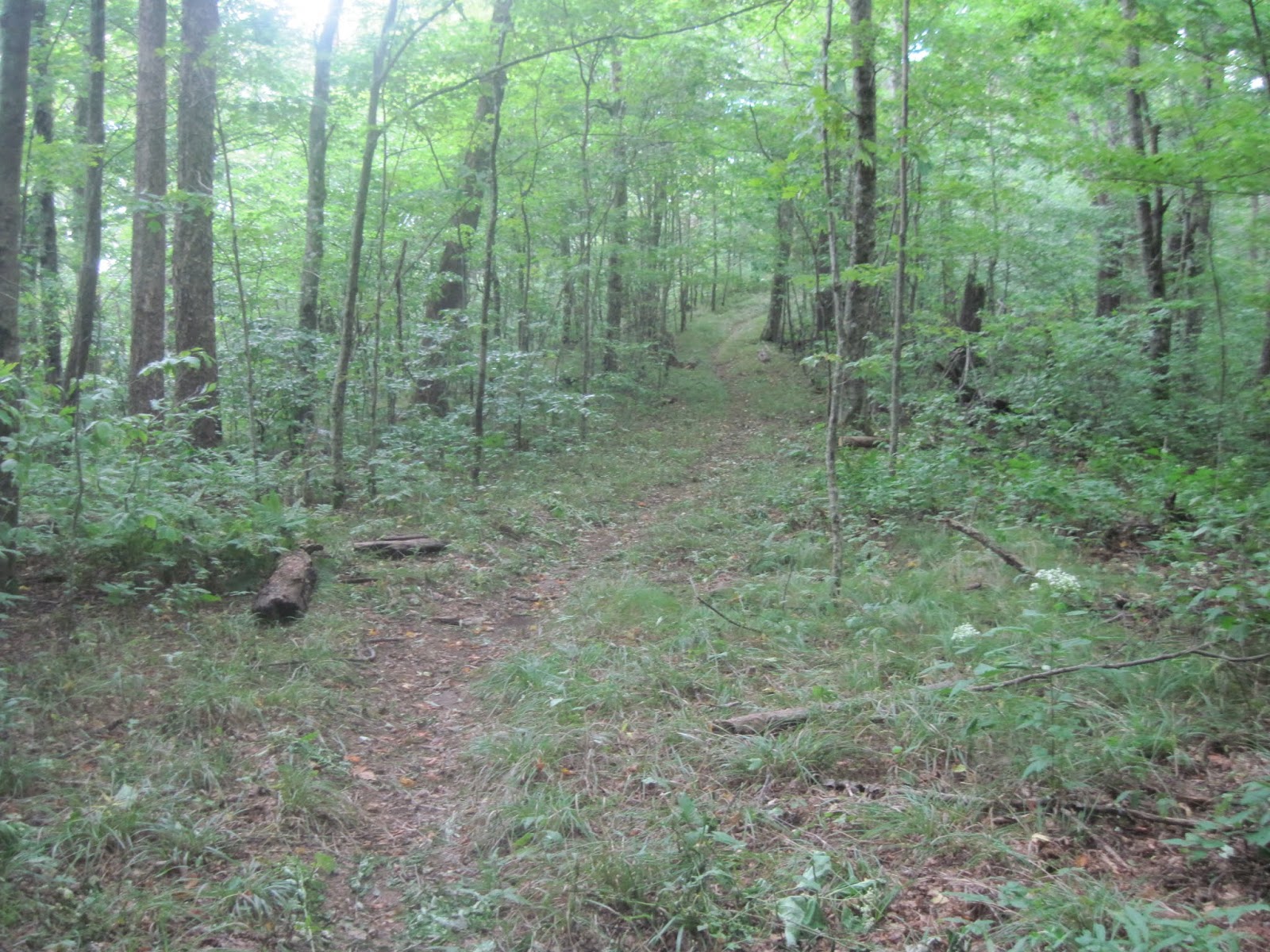
The "Mysterious One" and I arrived at the Dripping Springs campsite (#26, 4400' elv.), in the early evening after coming up Middle Prong to Panther Creek, where we rock hopped the stream and began the long ascent up the mountain. This route is like many others in the Smokies, a continuous incline.
Along this 5.5+ mile hike from the MP trailhead up to Dripping Springs one gains over 2000' in elevation, sometimes quickly, sometimes slowly.
We had our permit and camped for two nights, Saturday and Sunday, spending Sunday on an 11 ml hike up to the AT and then south to the Derrick Knob shelter, where we had lunch and rested.
Several of the AT shelters were still closed at this time due to bear activity. However they have since re-opened with warnings. As are several backcountry campsites, so I'd recommend checking the park website or copy and paste this link for the latest, (https://www.nps.gov/grsm/planyourvisit/index.htm).
Throughout Saturday there was a consistent rumble of thunder but we made the 11 ml day hike without seeing any rain. Until we returned to our camp and were getting ready to get dinner, "and then it rained".
As I have noted in previous entries about this campsite, it is very comfortable and well off the Miry Ridge trail but gathering water is an event to plan for.
The source is dependable mostly but with very little flow, thus the name "Dripping Spring".
All routes of access for this site would be considered difficult in terms of elevation gain and/or distance for the novice, especially if carrying a backpack. However, it is beautiful walking along the ridges and saddle to get there, and to continue up to the AT. Enjoy

Friday, June 29, 2018

Some areas reopen after flooding rains close parts of the Great Smoky Mountains NP

Use Caution folks.
Little River Road from Metcalf Bottoms Picnic Area to the Townsend Wye will remain closed due to down trees and rocks.
Elkmont Campground, Little River Road from Sugarlands Visitor Center to Metcalf Bottoms Picnic Area, Metcalf Bottoms Picnic Area, Upper Tremont Road, and Wear Cove Gap Road have all been opened.

Wednesday, overnight, the park received heavy rain at high elevations across the park including 2.54 inches of rain recorded at Clingmans Dome. Over a 6-hour period, Little River rose approximately 6 feet above the normal level at the Townsend Wye. The park continues to monitor flood waters across the park.
Stream crossings at lower elevations may have already, or will become more challenging and thus dangerous as the water flows down the mountains. Be smart and do not be to proud to turn around.

For more information on road closures, please follow SmokiesRoadsNPS on Twitter.

--NPS--


Tuesday, June 26, 2018

Blooms and Bears in the Smokies

These are some of the annually gorgeous blooms I've been able to see this spring and early summer. The bear I saw earlier this month.


Thursday, June 21, 2018

Rabbit Creek Trail

The Rabbit Creek Trail is accessible at the west end of the park near the Abrams Creek camping area.
The trail begins with a wide stream crossing where you'll have to remove your footwear because the bridge is still out from flooding a couple of years ago.
I'd recommend you not lace up your boots until after you cross Abram's Creek; using caution and a hiking stick or pole as you cross.


There are a couple of places being used for the crossing, however one is all torn up and muddy from horses and their passengers, while the other presents a challenge in safely getting from the rugged steep shore into the water.
This trail would be considered moderately difficult for the avid hiker. However if your hiking experience is limited or you're not used to extended inclines in your hikes it would be considered more on the difficult side of that.
We hiked into campsite #15, and returned which is approximately 7mls+. This trail provides access to some areas of the park which are traveled less and awesome routes for backpacking overnight.
David took these photo's on the hike June10th, 2018.

Old Sugarlands Trail

While my friend David was over from Nashville he had the opportunity to stay busy hiking and enjoy some new routes for him in the Smokies which included the Old Sugarlands trail, and a portion of the Rabbit Creek trail.
The Old Sugarlands trail is a moderately difficult walk, accessible from the parking lot at the Sugarlands Visitor Center (SVC), or a small parking area just up the road towards Gatlinburg from SVC.
David reported with delight his experience on this trail with the blooming plants, the remnants of the old cabin along the route and his first time for "working with" a bear on his own. I say "working with", in describing his reaction to the two cubs he encountered along his hike in this trail.
He stopped, identified himself to give the bears a further heads up, increased his distance by backing up slowly and began looking for momma bear, who he quickly spotted on the ridge. And if I remember correctly he told me that the cubs ran in opposite directions, up trees and the mother bear (That's her in this photo he took), vocalized her presence and kept an eye on him. As the initial surprise for everyone faded "Deep Dave" continued to "talk" to the bears as he made his way down the trail.
This hike Dave took was on June 9th, 2018.

Hiking in the Great Smoky Mountains National Park (GSMNP) 2018

Dudes! and Dudettes!, Over the past month the Rhododendron's have begun to bloom in full, the flame Azalea's have pretty much come and gone, though I saw some still scattered along a trail I hiked yesterday, and the busy season for the GSMNP has begun.
Wow, it's pretty dry at my house in the foothills right now. 
Though there has been scattered rains throughout the region over the last few weeks my immediate area has been missed, and regionally, with that lack of consistent rain some of the backcountry watering holes may be dropping.
 So plan your hike with alternative routes and destinations in case there is an unexpected crowd of people, a trail closure or weather event you have to make adjustments for to find some peace. Remember to hydrate! Drink water.
Sodas and other caffeine based drinks are not good for this purpose. They are diuretics and thus tend to remove fluids and other things our bodies need when exerting ourselves in hot humid weather.
For the most current information in the Smokies check the twitter account at https://twitter.com/gsmnp, or call the Sugarland's Visitor Center at 865-436-1297.
My friend Dave, from Nashville took this photo OTG from a trail we hiked a couple of weeks ago and those pics in the following post describing some other trails we hiked on his visit.

Tuesday, May 15, 2018

Rich Mtn Trail

Dudes and Dudettes! We have been doing some hiking this spring! One of the longer day hikes was along the Lumber Ridge trail out of Tremont, to the manway at 4 mls, and down to the falls. The Mysterious One and I took this walk in late March with a bunch of bright blooms going on along the way. I had taken like over 100 pictures which I was transferring to my laptop and in my haste I hit the wrong button!!!  Ugggh, waaaa! The pictures are gone from my world.  Now I am betting that if I new enough about computers I could find them somewhere but I have tried and can not at this time.
Lot's of blooms still happening! With the rodo's and Mountain Laurel yet to come! The laurel is on the verge and I have seen small patches of it blooming this week. This was one of many flowers blooming along Rich Mtn trl.


Bear's are moving around looking for early spring delights/food. Some moms need to fatten up after spending the last few months cooped up with new baby bears. This young tagged bear was along the Laurel Falls trail last week when I was up helping, as a volunteer, with Bear Management and visitor education.
The bugs and snakes are out so use some caution or awareness and maybe some bug spray.